Wednesday, May 28, 2014

Park 46: Pinnacles National Park (and Lands End Lookout at Golden Gate NRA)

5/28/14. We started our morning at Lands End Lookout which is part of the Golden Gate National Recreation Area. We became fascinated with the ruins and history of the later 19th century Sutro Bath House.
The pictures of the original structure made it seem like it was right out of a Victorian novel.


We also walked down to the Cliff House, trying to imagine the huge Victorian structure that once sat on the cliff in all its elegance.


Here's a picture of the Cliff House from 1902:
 The beach was also fascinating. The waves were beautiful, coming in row after row, but there were signs all over the entrances saying that people who swam or waded in the water have drowned here. Needless to say, there was no one in the water as far as we could see down the coast. We began to understand why they wanted the huge bathhouse to swim in.


We drove down the coast for a ways, stopped at Fort Funston for the amazing views of the water and coast, then headed into the mountains on our trek to Pinnacles National Park. We were curious to see this newest National Park although we knew that the "bat caves" that are a focus of the park would not be open because the bats can't be disturbed during the summer.


We arrived after a long journey into the barrenness of the desert and mountains. This is a very remote park! We thought there would be very few people visiting here because of the long, hot, barren drive, but the ranger told us that they were very crowded this weekend and all the camping spots were reserved at one point.

We drove up a little ways to the  Gulch and did one of the shorter trails. It was peaceful and quiet and the wind in the trees was lovely. We didn't think that this park was all that special compared to other national parks, however. Most of the views and experience were similar to areas outside the park. We assume that we needed more time here and needed to experience more of the park to discover what made it worthy of national park status.


We left the park and headed southeast to the I5 in the Central Valley. Oh my goodness, it is hard to describe the barrenness and desolation of this drive! It was a couple of hours of dry, barren land with an occasional ranch. It looked the setting from western movies like Rango! We were so happy to finally make it back over the mountains into the Central Valley and hit the Interstate! I don't think we would hurry back to this park given how hard it was to get to. But we are looking forward to exploring more of the California park units this summer!


Monday, May 26, 2014

Park 45: Muir Woods National Monument


5/26/14. After spending the morning at the Mary Blair exhibit at the Disney Family Museum, we drove over the Golden Gate Bridge and up the hills to the Muir Woods National Historic Monument. The weather was perfect and the park was quite crowded. It was great to see so many people who wanted to experience the amazing beauty and feeling of the national parks.

We really enjoyed learning more about the redwoods and comparing them to our experiences with the Sequoias in November. There was a similar feeling of quiet stillness and awe. We loved all of the redwood sorrel growing in the underbrush. They looked like huge clover. It was also cool to see all the spring growth on the ends of the tree fronds.
We again realized how much we love trees - it must be from growing up with so many trees. Here are more photos of the woods from our terrific afternoon:


Sunday, May 25, 2014

Parks 43 & 44: Presidio of San Francisco/Golden Gate Recreation Area and Fort Point National Historic Site

5/25/14. We left from Southern California this morning and hit the I5 at 7am to head north to San Francisco. We were amazed again at the vast expanse of agricultural fields once you get over the Santa Monica Mountains.

This time, evidence of the drought was everywhere. It truly looked like one big desert with patches of bright green where the fields are irrigated. Many fields of nut trees were completely dead.


We were thrilled to see the coast and the green lushness of San Francisco. After we got to the city, we headed right for the Presidio since it was almost 3 pm. We stopped first at the Visitor's Center and decided to change our plans slightly and visit the other park sites before they closed today.
As always, the ranger was very helpful and we did a walking tour of the Presidio's main military post. It was a beautiful clear, cool day and there was a Memorial Day celebration on the main parade ground with music and food tents. We had some fantastic cheesy grits and strawberry lemonade on our walk. 
The buildings reminded us a great deal of Fort Hancock at Sandy Hook. They had similar barracks and officer's quarters, although many of the buildings had interesting Spanish architecture incorporated into the eastern style.

Next we drove down to the parking are by the bay and walked along the path down to the water. The views of the Golden Gate Bridge and the San Francisco Bay were unparalleled. It was truly a perfect weather day.


 We stopped at the Warming Hut and got a passport stamp, then walked along the bay to Fort Point. This fort is very well reconstructed and looks very much like the other forts we've visited such as Fort Clinton in NY.  The gift shop had just closed when we arrived so Catherine convinced one of the young rangers to let her in to get our passport stamps.

We walked back up the hill to our car, enjoying the amazing view of the bay. It was a terrific day and we are excited to explore more of the San Francisco area tomorrow!

Saturday, November 30, 2013

Parks 41 & 42: Sequoia and Kings Canyon National Parks: Day 3


Top of the walkway to the General Sherman Tree
11/30/13. Today, our last day in the parks, was busy and full of amazing sights. We had breakfast and checked out of the John Muir Lodge - which we loved, by the way. It was clean, quiet, and had a wonderful big community room, all nestled into the trees. Having no TV did not bother us, but it was a bit tough that the wifi didn't work. We could get cell phone service at the lodge and visitor's center area, but nowhere else in the park.


Frost on the railing at Lodgepole Visitor's Center
We headed south on the Generals Highway into Sequoia National Park. We tried to stop at the Lodgepole Visitor's Center but it was already closed for the winter. The temperature was just under freezing and the frost made everything sparkle.


Frost on a pine tree at Lodgepole Visitor's Center

We continue to work our way through miles of tremendously tall pine and cedar trees wondering where the Sequoias were. All of sudden we entered a grove of tremendous sequoia trees and from there on we were amazed at the amount and size of the trees.

We stopped first at the General Sherman tree which is the largest tree on earth and a big tourist spot. There were quite a few people, but it wasn't crowded. The walk downhill was very steep with terrific views of the Giant Forest. We took lots of touristy photos and enjoyed walking among the giants.


General Sherman Tree


Top of General Sherman Tree


We left this area and continued south to the Giant Forest Museum. We got our passports stamped and looked at the exhibits. We learned more about how important fire is for helping sequoias reseed and how the parks have been preserving the area - including removing many of the buildings and asphalt that had been built up through the 1970's.

Brad on the start to the Moro Rock trail


We left the museum and drove to Moro rock which is a granite dome rock formation with a 400 step staircase winding up the side. The staircase, like other projects in this park, was completed by the Civilian Conservation Corps. We headed up the steps and got most of the way before deciding that we'd gone high enough. We got incredible views of the mountains from the way up:
Panorama of Moro Rock

Climbing Moro Rock Staircase
View from Moro Rock


The Parker Grove of Trees
We next headed to the Tunnel Tree and waited in line to drive through the tree tunnel with the other tourists. It was fun because we helped each others' families take pictures and there was a great sense of silly fun.


We also stopped by the "auto tree" where people years ago had filled a fallen tree with concrete and drove a car on it. Brad and Catherine had fun pretending they were driving on it too.


We left that area and headed south on an extremely winding road down the mountains. Brad drove with the car in first or second gear the whole way. We stopped frequently at the turn outs to admiring the changing ecosystem as we got into lower altitudes.


We finally arrived at the Foothills Visitors Center at the southern most point of the park. We got our stamps and looked at the exhibits. We were very glad that we decided to start our trip up north at Kings Canyon and work our way down through Sequoia. It seemed a natural progression and worked well logistically. We were sorry that many roads and attractions such as the crystal cave, were closed for the winter but it gives us a reason to come back again!


We left the park and since there was nowhere to get food south of Wuksachi Village we were really hungry. We stopped at Case Mendoza in Three Rivers and had terrific Mexican food. Big portions and great flavor. We'd definitely go back if we were visiting the park again. From there we made the 5 hour ride back to LA. Thankfully the traffic was good and we got home tired and happy.

Friday, November 29, 2013

Parks 41 & 42: Sequoia and Kings Canyon National Parks: Day 2

11/29/13. Catherine and I got up early and headed to the main room in the lodge and got a fire going in the huge fireplace. We started a very difficult round puzzle and got help from a charming little 7-year old boy named Thomas. He kept us company until we had breakfast at the lodge restaurant.

We learned from the Park Ranger that Ponderosa Pine bark smells like butterscotch!!

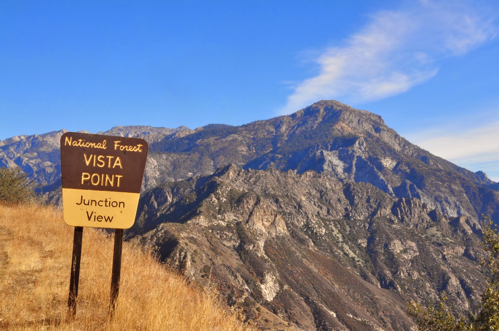
After breakfast, we headed north in the car on the Generals Highway to the Junction View. We stopped at various pull outs along the way, awe struck at the amazing views of the mountains. We left Kings Canyon and entered the Sequoia National Forest area along the way. Because we were outside of the park, we stopped to get some huge and beautiful Jeffrey pine cones.


Collecting pine cones (outside the park, of course!)


We also stopped at one pull-out and hiked down to a rock out-cropping where we were surrounded by unobstructed mountain views. We enjoyed sitting quietly amid the splendor. (I pretended I was John Muir seeing this for the first time!) We also discovered we could take panoramic photos with our phone cameras.


Hume Lake
We continued south towards Hume Lake where there is a dam and man-made lake. There is also a large campground in the area. We got out here and walked around the lake area.


As we continued south we passed other viewing spots and entered the Sequoia National Park. We completed a full loop, heading back to the Grant Grove area of Kings Canyon.


When we returned to the lodge, we had a late lunch and then hung out at the common room for the afternoon, working on our puzzle, getting some school work done, and playing card games. It was a relaxing end to our day.


Working on our puzzle


Catherine and Brad walking towards the restaurant from the Lodge