Saturday, July 25, 2015

Park Unit 63 & 64: Valor in the Pacific National Monument (Tulelake) and Lava Beds National Monument

7/25/15. We drove through miles and miles and miles of remote volcanic landscape to get to the Lava Beds National Monument.The best part of the drive to the park were the fabulous views of Mount Shasta. 


Just before heading on the main road to the park, we stopped at the Valor in the Pacific National Monument in Tule Lake. This was a Japanese-American
Internment Camp during WWII and was very similar to the Manzanar site we visited last year. There is not much here, but the Park Ranger was very informative.


We continued on for many more remote miles to the visitor center at Lava Beds National Monument. It is noted for its many caves and lava flows. We started out visiting the most accessible cave, the Mushpot, near the visitor's center. It was really interesting! The "cool factor" of being in a lava tube cave was very high and it was amazing to see the lava formations in stripes where it flowed down the tube. The ceiling of the cave looked like rough stucco from where the lava dripped and splashed. It was so hard to believe it was all real!


The remainder of the afternoon, we stopped and viewed lava flows and other formations. The black rough rock was everywhere and clearly showed the violent volcanic activity of centuries past.


We visited Fleener Chimneys which are spatter cones. These are tube-like chimney vents from which the basalt lava was flung. We climbed up the hill so that we could actually look down the chimneys. 
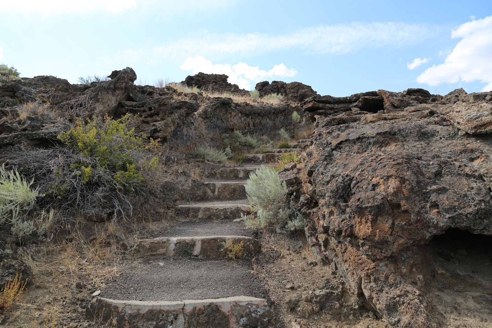


This park was well cared for with lots of wayside exhibits, picnic areas, etc. Not surprisingly, it was not crowded, since it is in such a remote area. We thoroughly enjoyed sitting in the sun, listening to wind and nothing else, enjoying the remote solitude.

Friday, July 24, 2015

Park Unit 62: Lassen Volcanic National Park

7/24/15. Wow, what an amazing park! We started off this morning walking up to the  "Sulphur Works" which are boiling mud pots by the side of the road. These were just incredible - like right out of a movie.  Here's a video of what it looked like:


The smell of sulphur and the hot steam were overwhelming.


Next we hiked up to Bumpass Hell Overlook. This was a 4 mile trail that was very challenging, especially at 8,000 ft. Although it was hard to breath and strenuous, the view of the steaming hydro-thermal area was worth it! The temperature of high-velocity steam jetting from Big Boiler, the largest fumarole in the park, has been measured as high as 322°F (161°C), making it one of the hottest fumaroles in the world.


We spent the rest of the afternoon driving to other areas of the park and we had a lovely picnic lunch beside one of the mountain lakes. The sky during the whole day was a deep, deep clear blue without a single cloud. The air, although thin to breath, was clear, refreshing and very cool. There were many wildflowers in bloom and stunning views everywhere. This park is so pretty it must be where they must shoot the photographs for jigsaw puzzles and calendars!


After lunch we drove through the "Devastated Area" where one of the volcanoes erupted in 1914. The lava rocks were fascinating!


This shows the volcano in the distance and the rock that was thrown miles away.


Late in the afternoon, we went to the far side of the park to hike up to Cinder Cone and the Fantastic Lava Beds. The lava beds were a huge wall of broken chunks of rock that had spewed from the volcano hundreds of years ago.


This area was once a National Monument on its own, but were later incorporated into Lassen National Park when that was created. This cinder cone volcano looked like the surface of the moon and the whole area had the feel of outer space. It just didn't look real. We hiked to the bottom of the cinder cone, then Jason went on his own about a 3rd of the way up the extremely steep path. He vowed to return one day to get all the way to the top.


Here's a view from the path up the cinder cone that Jason took:


We left the park at dusk, completely exhausted, filthy with volcanic ash and dust, and thoroughly amazed at the beauty of this wilderness.

Thursday, July 23, 2015

Park Units 60 & 61: Eugene O'Neill National Historic Site and Whiskeytown National Recreation Area


7/23/15. Today on day 4 of our California Road Trip, we started the morning with a tour of the Eugene O'Neill National Historic Site. The park is way up on the side of a hill in Danville, Ca so visitors take a shuttle up to the site and need reservations for a tour. According to the National Park website:"America's only Nobel Prize winning playwright, Eugene O'Neill, chose to live in Northern California at the height of his writing career. Isolated from the world and within the walls of his home, O'Neill wrote his final and most memorable plays; The Iceman Cometh, Long Day's Journey Into Night, and A Moon for the Misbegotten."


I can certainly see why this location was ideal for someone who wanted peace and quiet and a place to write. We learned a lot of interesting things about O'Neill and the tour guide inspired us to see/read some of his plays.

This was a small park unit and didn't take much time, so we got on the road again and headed north to Whiskeytown National Recreation Area. The ride was about 4 hours and we reached the park about 5 pm when the area had cooled off to about 85.


The highlight of this recreation area is the magnificent lake created by a dam. There are many water activities and we waded into the clear, warm water of the lake.


The late day sun gave beautiful views of the trees, hills, and streams. We will be staying in this area for a couple of days, so we hope to return again to see more.

Wednesday, July 22, 2015

Park Unit 59: Point Reyes National Seashore

7/22/15. On day 3 of our Northern California Road Trip we visited Point Reyes National Seashore. In order to get to the park, we drove through the Samuel P. Taylor State Park and a bit of the Golden Gate National Recreation Area. This area had very tall conifer trees and reminded us of the John Muir Woods.


We finally arrived at the visitors center and got a map to choose our approach to visiting this large park. We took the road to the lighthouse and detoured up a road to one of the peaks. It got very very foggy and cool and the wind blew the clouds around us. There were some good views of the expanse of the park, which is a very interesting geological formation. Here's how the National Park Service describes it:

"Geologically, Point Reyes National Seashore is a park on the move. The eastern border of the park parallels the San Andreas Fault, which is the current tectonic plate boundary separating the Pacific Plate from the North American Plate. If you draw a line through the middle of Tomales Bay in the north through the Bolinas Lagoon on the south, this is the path of the San Andreas Fault Zone. Faults come in three types: divergent, convergent, and transform. The San Andreas Fault is an example of the third--a transform fault--where plates pass one another like cars on a two way street."

As we drove to the lighthouse at the end of the southern point, we were surprised at how much the rocky coast and barren landscape reminded us of the Channel Islands to the south.
There were ranches with cattle and lots of brown grasses.Some small bushes and flowering plants clung to the rock. It seems so odd to have a place so dry right along the coast.


The actual coastline is home to harbor seals in the rocky coves. 


The western edge was a magnificent beach with strong breakers all along the many miles. On top of the lighthouse point, the wind was so strong it was hard to stand against it. The late-day sun made gorgeous sparkling white patterns on the ocean, which stretched as far as one could see.


Point Reyes Peninsula felt isolated and exotic. This park was so much more interesting than we expected. There is a tremendous variety of different geology, plant, and animal life. The area of the park is very large - it took us almost an hour just to get to the lighthouse point. All in all, it is very unusual and it really feels like the wilderness.

Tuesday, July 21, 2015

Park Units 56, 57, 58: San Francisco Maritime National Historic Park, Rosie the Riveter, and John Muir National Historic Site

7/21/15. On day 2 of our road trip we started exploring the national park sites in the San Francisco Bay area. We drove into San Francisco and parked at Fort Mason, which is part of the Golden Gate National Recreation Area. We walked around the grounds and finally figured out the way to go up, over and down the hill to the San Francisco Maritime National Historic Park.

We spent some time in the wonderful visitors center learning about the history of the area and lots of information about maritime processes and life. This site also has a group of historic ships which you can board, and amazing views of Alcatraz and the San Francisco Bay.


We spent some time at the Ghirardelli Square which is across the street, then we walked back to Fort Mason. Many of the old military buildings have been redesigned as non-profit performance spaces and small business locations. We ate lunch there at "Greens," an amazing vegetarian restaurant with incredible views of the bay.


After lunch we drove across the bay to the Rosie the Riveter WWII Homefront National Historic Park. According to the National Park Website, you can "explore and honor the efforts and sacrifices of American civilians on the World War II home front.  Find out how they lived, worked and got along. Many faces, many stories, many truths weave a complex tapestry of myths and realities from this time of opportunity and loss."

We were lucky enough to hear a lecture by 95-year old Betty Reid Soskin who spoke about life as a Black woman during that time period. She worked as a clerk for the shipyards during the way and today she gave us a moving and fascinating perspective of the racial issues the arose as so many diverse people worked together toward their goal of ending the war.

We finished our visit here sooner than expected so we headed south to the John Muir National Historic Park. John Muir, of course, if the father of the national park movement and this site is where John Muir's home was. He was actually a very wealthy man from selling fruit from his acres of land. This wealth allowed him the privilege of writing and traveling so much. His house was typical of the time period, but we got to go to all 3 floors, including a bell tower above the roof. We enjoyed trying to identify the fruit trees and we learned quite a few we didn't know! We weren't surprised to find that he also planted a few Sequoia trees on his land. As always, they were impressive!


In order to avoid the traffic getting through the city, we stopped for dinner in Berkely. After exploring the town a bit, we settled on a pizza place.

By the time we left, the traffic was gone and we were treated to a lovely sunset over the bay on the ride back.